Rockslides In The Arctic: Why Do We Care?
SCIENCE / COMMUNITY
Writers: Reginald L. Hermanns, Thomas F. Redfield & Ivanna M Penna, NGU – The Geological Survey of Norway, Vilborg Einarsdottir
Photographs: Reginald L. Hermanns,
François Noël, SLD
Graphics: Dave Gauthier, Google Earth
May 2021

Global climate warming is nowhere as severe as in the Arctic. One consequence of many is a widespread reduction in permafrost. Continuous, stable permafrost can act as a physical glue that helps anchor unstable slopes. As permafrost thaw becomes more widespread, scientists are increasingly reporting collapses of rock slopes in the High Arctic.
The Arctic is sparsely populated and most rockslides or landslides that are caused by the loss of permafrost go unnoticed. But when they are sudden, unpredicted, and close to settlements, these events make it into local, national, or even international news - because of the devastation and suffering, even fatalities they can cause in small, remote communities with limited resources to instantly respond.
A group of scientists from NGU, The Geological Survey of Norway has been researching rockslides in the Arctic and this article is based on their research notes.
Dangerous and even fatal
A good example of rockslides in the Arctic was when 300.000 cubic metres of fragile sedimentary rocks slid into Svalbard’s Isfjorden on August 12th, 2016. The rockslide originated from a much larger rock slope instability at Forkastningsfjellet, some 10 kilometres north of Longyearbyen. The slide caused no damage, and no displacement wave was observed in Longyearbyen’s harbour.
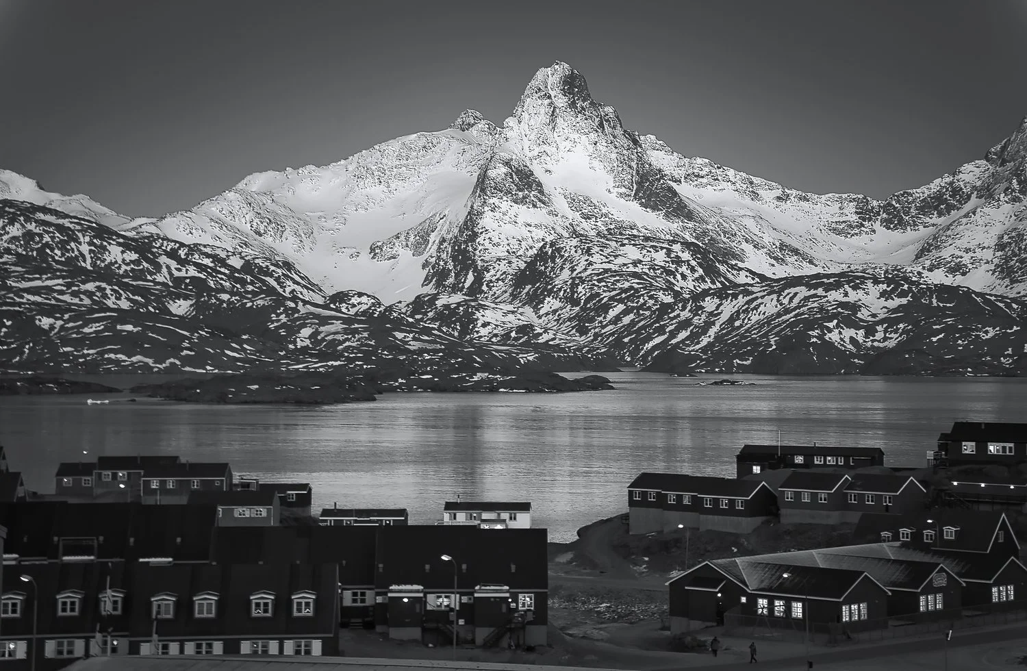
Nevertheless, coastal Arctic rockslides can potentially be very dangerous and even fatal. A stark reminder of such a rockslide happened in the Karrat fjord in northwestern Greenland on June 17th, 2017, causing a displacement wave. Although the rockslide was some 30 kilometres from the village of Nuugaatsiaq, the wave or tsunami it caused was over 10 metres high, devastated the village and took the lives of four persons.

Rock avalanche deposit with a volume of about 1.000.000 cubic metres from a sudden failure in autumn 1986/1987 on the east side of Porsangerfjorden. This is the slide that rocked Alfred Karlsen’s fishing boat. JONAA©François Noël
Why are the numbers of reports growing?
The increasing availability of new data makes it easier to detect rock slope failures. By comparing historic aerial photos from 1976 and 2007, scientists from the Geological Survey of Norway (NGU) identified the scarp from a rock slope failure on the east side of Porsangerfjorden. The slide is estimated to have had a volume of about 1.000.000 cubic meters of bedrock.
Searching for eyewitnesses in the nearby harbor of Honningsvåg, we met Alfred Karlsen. Karlsen recalled that the event occurred in autumn 1986 or 1987. He had been about two nautical miles away from the slide and rode out the 7-to-8-meter-high waves caused by the impact in his fishing boat Morning Star. Public awareness has risen since then: such an event would have been big news today.
Does climate warming contribute?
We know from the dating of deposits and from mapping fjord infill that rock slope failure activity was much higher during the two millennia after deglaciation in Norway than it is today. Our research also indicates rock slope failure also occurred at the 1300-meter-high unstable rock slope of the mountain called Mannen about 5000 years ago, at the end of the Holocene Climate Optimum.
This was the warmest period after deglaciation, and permafrost models indicate that permafrost had disappeared at that site at that time, suggesting degrading permafrost as a contributing, or even causative, factor.
The dating of rockslide scars in northern and western Norway with cosmogenic isotopes (isotopes created when cosmic rays interact with atoms on Earth) also helps us to better understand the long-term deformation of rock slopes.
The first results show two groups of rock slope deformation, initiated in different eras. One group started moving after deglaciation. The second became active during or at the end of the Holocene Climate Optimum when permafrost was reduced.
A cause for worry at several sites is that today’s sliding rates are faster than the long-term millennial average. Because rock temperatures have been rising since the Little Ice Age, we may be identifying a climatic control of slip rates.
This is also indicated by a statistical analysis of the more than 500 unstable rock slopes that are registered in the unstable rock slope database at NGU. More than a hundred of them were recognized on InSAR data shortly after the data became public in 2018 (www.insar.ngu.no).
The rockslide at Reinbenkan, with a volume significantly larger than 10.000.000 cubic meters. The sliding surface exposed at the top is over 80 meters high. Reinbenkan is located on the northeastern shore of Porsangerfjorden in North Norway. In the background, a cruise ship sails on the Barents Sea. JONAA©Reginald Hermanns/NGU
The rockslide at Reinbenkan, with a volume significantly larger than 10.000.000 cubic meters, located on the northeastern shore of Porsangerfjorden in North Norway is one example. Data show that the vast majority of rockslides that have higher velocities today occur within areas where the permafrost is sporadic or discontinuous.

The Reinbenkan rockslide is clearly visible in the topographic map. Source: http://geo.ngu.no/kart/arealis_mobil/
You may delay, but time will not
Life in the Arctic will inevitably change in the coming decades. By the end of this century, the Arctic Ocean is expected to have a very reduced sea ice cover. In the worst case, it will be virtually ice-free. Northern shipping routes crossing the Arctic Ocean are 25% shorter than those currently connecting Europe and Asia, and thus less costly.
A growing tourist industry will also increase human presence in the Arctic and the Arctic Ocean. Increased presence means increased exposure to rockslides and the dangers they pose. This highlights the need for a better understanding of the linkage between rock slope stability and climate-driven permafrost degradation.
In the High Arctic, field parties have begun pilot projects to assess potential rockslide threats in Svalbard and Greenland. These projects have been carried out by scientists from Norwegian, Danish, and German geological surveys, and we intend to collaborate further in the future. We hope that additional studies will soon help make the Arctic safer for travelers and residents. As Benjamin Franklin said: “You may delay, but time will not.” And William Shakespeare would have agreed: “Better three hours too soon than a minute too late!”.


Aerial pictures of the “Main landslide” at Karrat taken from a helicopter on the day after it occured. JONAA©SLD

Looking down on the Main landslide at the Karrat fjord. JONAA©SLD
The Karrat fjord landslide
These photographs were taken by the technician on Air Greenland’s Search and Rescue helicopter that flew on a mission the day after the Karrat Fjord landslide occurred in northwest Greenland in 2017.
This slide which was really made up of three joint slides, stretching over a horizontal distance of 3100 meters, happened on a steep, south-facing mountain slope with total vertical relief of greater than 2100 m from sea level to the ridgetop.
The landslide set in motion a tsunami that would destruct a small village, Nuugaatsiaq, roughly 30 km away; demolishing several houses, damaging others, leaving many of the roughly 80 villagers and their dogs injured - and taking the lives of four people and numerous animals.
This happened on June 17th, 2017. For Greenland’s small nation of fewer than 60.000 people that date marks a tragedy still deeply felt. ▢

Graphics© Gauthier, D., Anderson, S.A., Fritz, H.M. and Giachetti, T., 2018. Karrat Fjord (Greenland) tsunamigenic landslide of 17 June 2017: initial 3D observations. Landslides, 15(2), pp.327-332.

Map from Google Earth showing the site of the landslide and the village of Nuugaatsiaq, 30 km way.
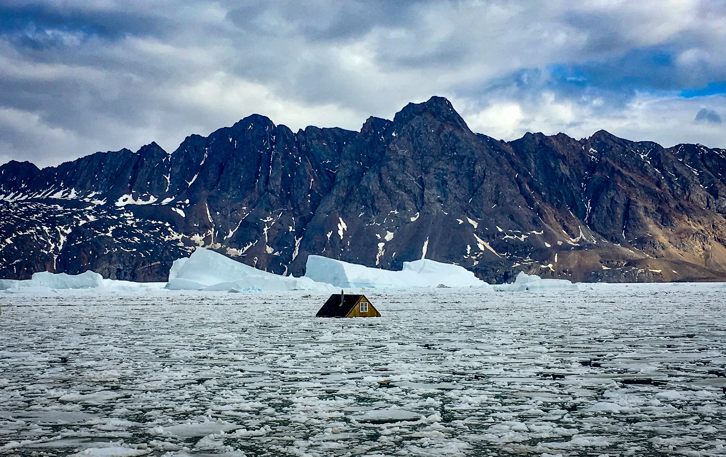
The picture of the single house floating in front of the small Nuugaatsiaq village. All photographs from the Greenland landslide and devastation of June 17th, 2017 in northeast Greenland are JONAA©SLD


The writers of the main article, Reginald L. Hermanns, Thomas F. Redfield & Ivanna M Penna are researchers working on this project are scientists at NGU – The Geological Survey of Norway. This article is published in a media collaboration between JONAA and The Fram Center in Norway.
The Greenland part is written by Vilborg Einarsdottir, the Editor-in-Chief of JONAA, the Journal of the North Atlantic & Arctic, and a JONAA partner & founder. Formally a journalist for 12 years at Morgunblaðið in Iceland, she has worked since 1996 as a specialized producer of film, photography, and media productions on extreme locations in Arctic Greenland and as a cultural producer in the Nordic-Arctic region. She is an awarded film and documentary scriptwriter and editor of photography books from the Arctic.